Official Name:
УгзгЙЕФЯЩНГЄГЧ1ЖЮMiZiGouNanShanChangCheng1DuanOur Name:
/
Other Name:
/
Period:Уї / Ming Dynasty 1368~1644
Location: КљТЋЕКЪа,ЫчжаЯи,Ц№ЕуЃКИпЕщзгЯчУгзгЙЕДхФЯЩНЖЋЦТжЙЕуЃКИпЕщзгЯчУгзгЙЕДх ЏХЃЙЕЭЭЖЋВрЩНЦТ(ФЯЩНЮїЦТ) / HuLuDaoShi,SuiZhongXian,QiDianGaoDianZiXiangMiZiGouCunNanShanDongPoZhiDianGaoDianZiXiangMiZiGouCunDiTouJiaoLongNanShanXiPo)
ЁЁ[
Looking Local List]
Details:ГЄГЧРрБ№ЃКЧНЬх
Ц№ЕуОЮГИпЖШЃКЖЋОЃК120Ёу 7Ёф ББЮГЃК40Ёу 19Ёф КЃАЮЃК80
жеЕуОЮГИпЖШЃКЖЋОЃК120Ёу 7Ёф ББЮГЃК40Ёу 19Ёф КЃАЮЃК88
ЧНЬхзпЯђЃКИУЖЮГЄГЧЭСЧНЦ№здФЯЩНЖЋЦТЃЌбиЩНЬхББЦТЯђЮїФЯжС ЏХЃЙЕЭЭЖЋВрЩНЦТжЙЁЃДѓЬхГЪЖЋББЃЮїФЯзпЯђЁЃ
ЧНЬхРрБ№ЃКЭСЧН
НсЙЙЬиЕуМАЙЙжўЗНЪНЃКИљОнЧНЬхБЛЦЦЛЕЕФЖЯУцПДЃЌЧНЬхЦЪУцГЪЬнаЮЁЃИУЖЮЧНЬхЛљДЁЮЊздШЛЩНЬхбвЪЏЛљДЁЃЌЧНЩэгУЛЦЭСКЛжўЃЌЧНЬхКЛЭСКЌдгЩАРљЃЌЧНЬхЖЅВПЩшЪЉЮоДцЁ
ЯжзДЃКЭСЧНЁЃЭСжЪвдЛЦЭСЮЊжїЁЃ
Type:ЭСЧН Rammed earth wall
Protection Level:Юо
ЁЁ
Content:
Memo:
Other Records:
Distribution:
visit location in Tianditu Map[recommend] Distribution:
visit location in Tencent QQ Map Distribution:
visit location in Google MapDistribution:
visit location in Baidu MapNational ID:211421382101170016
Action:[
 Save in Data Basket
 ]
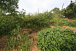
Picture:
Click the thumbnail to view the Big Pic. Click the Big Pic to Hide the Big Pic![Caption:УгзгЙЕФЯЩНГЄГЧ1ЖЮ
loading images --Please wait...]()
![Caption:УгзгЙЕФЯЩНГЄГЧ1ЖЮ
loading images --Please wait...]() Photo Links
Photo Links:
ЁЁ Search ::
  Favorite/My Favorite :: Recent Changes :: :: Login